Hmm, actually I'm not sure where I should start off with~
How about a brief introduction to Pulau Mandi Darah?
Pulau Mandi Darah got her name from the princess of Brunei, Puteri Laila. She was on her way back from the Philippines to Brunei in 1885 when she had her menstruation. She stopped at the island to wash herself up in a nearby well near a cliff of the island. She was astonished by the beauty of the island that when she went back to her ship, she asked the captain of the fleet what is the name of that island. She was thrill when the captain told her that the island had no names yet, and since she is of the highest rank in the fleet, she can name the island. That’s how the island got her name, as told by the Haji. Judging by the name the first time I saw, "Mandi Darah", I thought it was an island that had bloodbath battles before. Boo my opinions? Go ahead~
The island itself is not so big, consist mainly of sandy areas and a part with rocks and cliffs. It takes about 1 hours 15 minutes to walk around the island during ebb tide. When tide comes in, it will be harder to walk through especially the rocky areas where water will reach up to waist level and sting rays are a threat. Yes, Sting rays! We were at the rocky part during a neap tide when we encountered a sting ray. Somehow it was dangerous but the Haji's son, who was also our "tour guide" asked us not to move til it went away. Useful~
FYI, the island currently has 5 families staying there. Our camp site is located near to the Haji’s house in front of a surau. The Haji allows us to pump fresh water for cleaning and daily use from his nearby well. How generous of him. However, the water itself is groundwater with soil particles suspended and a bit salty, surely with a distinct smell. We used it mainly to bath and to clean our equipments after sampling or diving. We have our consumable water from 40 boxes of 1.5L drinking water as well as bout 20 RO water tanks. Imagine we had to carry these heavy water from one end of the jetty to the another then to ur camp site. Phew~ We also have a kitchen set up with a cook to supply us with every meal. Also, we had a lot of seafood throughout these 8 days. We got our seafood supply from the local fishermen. Cheap and fresh.
There is also a platoon of army staying there on the island in a permanent base. They are responsible to maintain the national security for that part of Sulu Sea because that area has lots of pirates and many cases of kidnapping and abduction had been reported. Illegal ships are more likely to be spotted due to its nearness to the Philippines (Sulawesi). Dangerous eh?
Here’s some pictures of the island:

 Behind is our kitchen (Under roof)
 The jetty that we used (Orange house is an observing and security post for a platoon of army)
 A view on the jetty
 Sunrise
 Sunset
 Before a thunderstorm
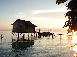
 An abandoned house on top of the sea
 A short trail to the other side of the island

 Beach at the other side of the island
Cheers!!


love the sunrise and sunset cap* photo...ayamashi na>_<
ReplyDeleteeh...i wan go oso eh~~
ReplyDeleted place looks so 'natural' o..wahaha
go la..
ReplyDeletelater kena pirates kidnap~
ban cy...not me>_<
ReplyDeletehey,
ReplyDeletei've been there also, for sampling.
but 12-16 july, 2nd phase.
such a beautiful island!